
How it works
From a hunch to a logged find
This is the actual workflow DeepFind Hunter is built around — nine steps from creating an account to sharing a find. Each step says which plan it needs and whether the underlying feature is Live or Beta today, including where a tool cannot give you a result yet and why.
What “Live” and “Beta” mean here
- Live
- Built and wired into the app, reachable in normal use, covered by automated tests, and able to work without waiting on an outside provider or approval.
- Beta
- Present in the app but not finished in practice — it may be waiting on a configured provider or real-device validation. Where something cannot produce a result yet, the app says so instead of guessing.
We would rather label something Beta and explain the limit than call it finished and have you find out otherwise in the field.
-
Step 01: Create an account and pick a plan
Sign up, and you are on Free straight away: $0, no card. Free covers the basics — the Treasure Map, the basic Detector Library, up to 3 saved locations, and up to 10 Find Log entries. Pro is $9.99 a month or $79.99 a year and starts with a one-time 30-day trial.
- Free is a real tier, not a countdown — it does not expire
- Pro adds unlimited Find Log entries and saved locations, the full detector library, full stats with CSV export, and the Pro-only research tools
- Subscriptions are billed by the app store on the device you subscribe from, and you cancel there too
Honest limits: During the closed beta there is no public app-store listing yet, so plan selection is exercised by invited testers rather than bought by the public.
-
Step 02: Open the map and choose your layers
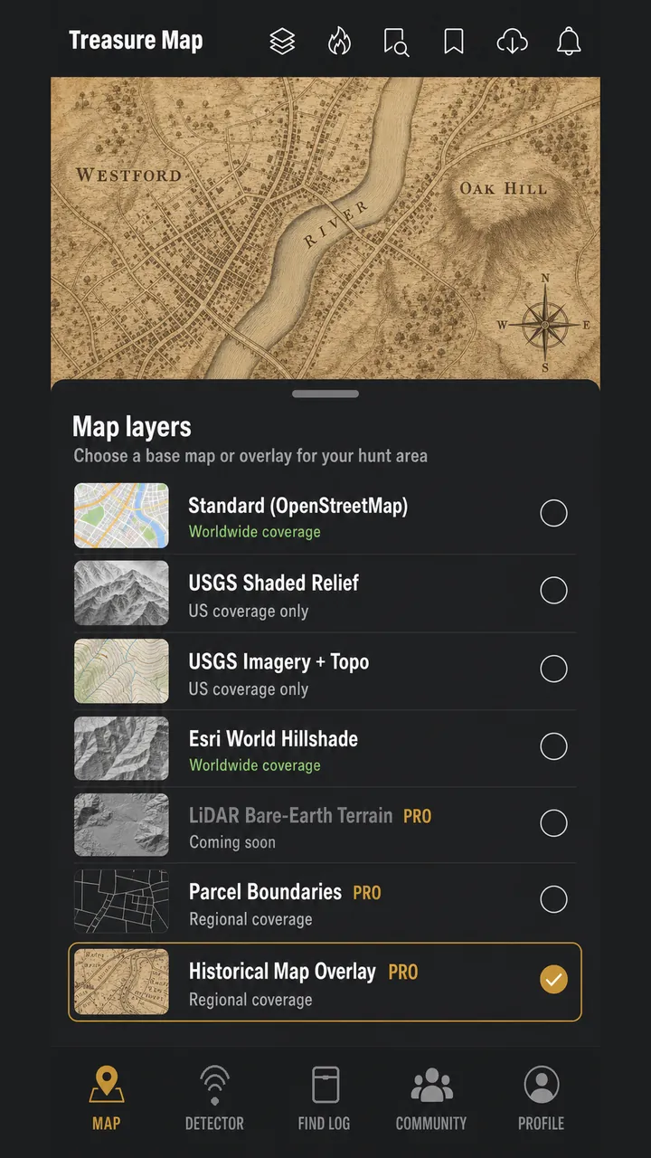
The Treasure Map opens on a standard worldwide OpenStreetMap base. From the layer switcher you can move to terrain layers that actually help you read ground: USGS shaded relief, USGS imagery with topographic detail, USGS topo, or a worldwide Esri hillshade where USGS has no data.
- Five map layers ship with real, working data sources
- The three USGS layers are public-domain and cover the United States only
- Esri World Hillshade is the worldwide fallback for terrain shading
Honest limits: Historical map overlays and parcel boundaries are Coming Soon — not included in the current Android beta. Production builds hide both placeholders until they have real data sources.
-
Step 03: Research before you drive anywhere
Pro adds the research layer of the app. Keep private, account-scoped notes on the ground you are studying, and run AI LiDAR Terrain Analysis over an area to surface terrain anomalies — possible cellar holes, foundations, ditches, old roads, disturbed ground — from public-domain USGS bare-earth elevation data.
- Every AI LiDAR candidate is labeled "possible" or "suspected" — never "confirmed"
- Where USGS 3DEP has no data, you get an honest "no LiDAR coverage here" instead of a guess
- Research notes stay private to your account
Honest limits: Beta. AI LiDAR Analysis runs as a server-side pipeline that must be deployed and configured before it returns results; until then it reports itself unavailable rather than inventing findings. It is a research aid to direct fieldwork — it is not evidence that anything is buried, and it is not archaeological or legal advice.
-
Step 04: Get permission — every time, before you go
This step is not optional and no app can do it for you. Identify who owns or manages the land, get their consent, and check what the law where you are actually allows. The app gives you somewhere to record permission details alongside your research so you are not relying on memory.
- Private land needs the landowner's permission — verbal is fragile, written is better
- Public land varies enormously: many parks, beaches, and reserves restrict or ban detecting outright
- Protected archaeological and historic sites, and human remains, are off limits — report, never dig
- Some places require a permit; some require finds to be reported to a heritage authority
Honest limits: Permission and access records in the app are entered by you, by hand. The app cannot look up who owns a parcel — no parcel data provider is connected — so it can never tell you that a specific spot is legal to search. That determination is always yours.
-
Step 05: Set up your detector and save the spot
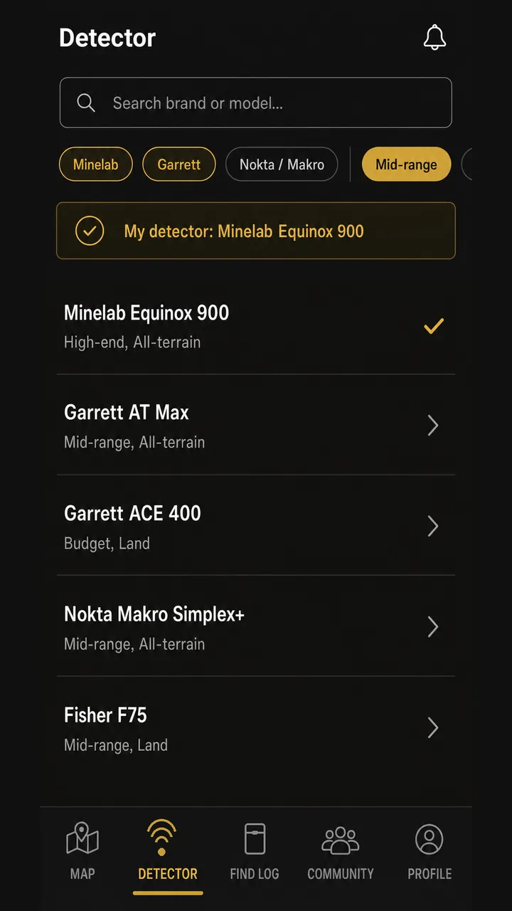
Search the detector library by brand or terrain, pick the model you actually swing, and save a custom profile with the settings and environment guidance that suit the ground you are on. Save the location so you can find your way back to it.
- Real, published detector models from Minelab, Garrett, Nokta, Fisher and more
- Custom profiles carry your settings between hunts
- Free saves up to 3 locations; Pro is unlimited
Honest limits: The library is a curated set that grows over time, not an index of every detector ever made. Free includes the basic library; Pro unlocks the full library and custom profiles.
-
Step 06: Record the hunt as you walk it
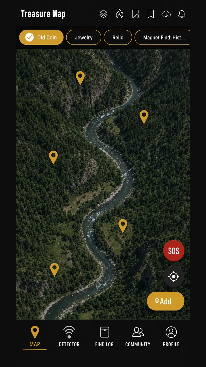
Start a hunt session and the app records your track on-device. It keeps recording with no signal at all, then reconciles with your account when you reconnect — so a dead zone costs you nothing. Afterwards you can review the walk and see where you actually covered.
- Recording works fully offline; syncing happens when a connection returns
- Review the recorded path on-device after the hunt
- One-tap recenter and an SOS control while you are out
Honest limits: GPS accuracy depends on your device, the sky view, and the conditions — treat a recorded track as a good approximation, not a survey. The SOS control is a convenience feature, not a substitute for calling emergency services.
-
Step 07: Log every find and watch the numbers build
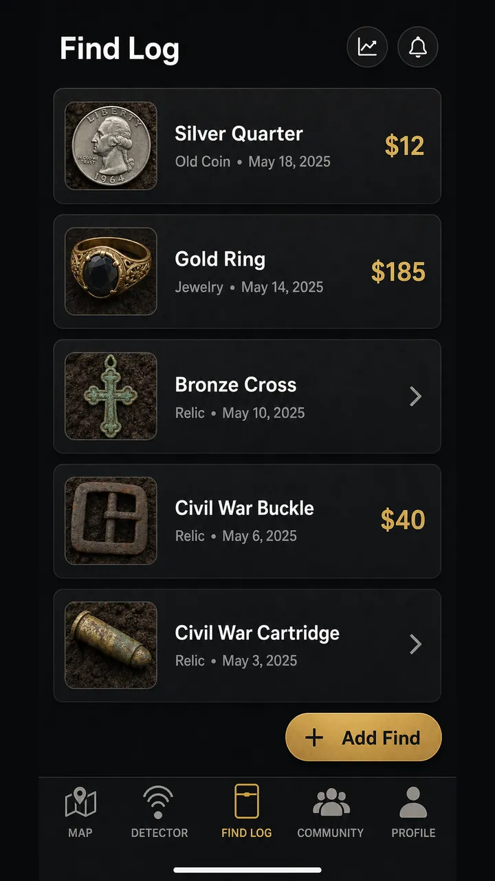
Drop a pin the moment you dig something, photograph it, and record category, depth, date, and your own value estimate. Find Stats turns that into a picture over time: category breakdown, a timeline, your most-used detector, and your best find.
- Photo-backed entries with depth in your preferred units
- Category filters on the map so your history reads as a pattern
- Pro exports the whole log to CSV
Honest limits: Value figures are whatever you enter yourself. They are your own estimates for your own records — never an appraisal, authentication, or valuation by DeepFind Hunter. Free stores up to 10 entries; Pro is unlimited.
-
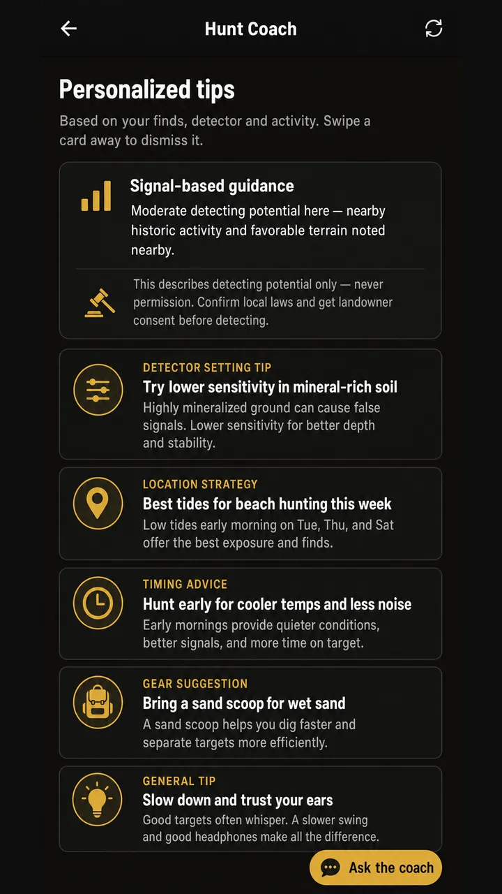
Step 08: Ask the coach for on-device guidance
The Hunt Coach gives plain-English guidance on signals, detector settings, location strategy, and timing, drawn from your logged finds and your selected detector.
- Hunt Coach runs on your device, so it works with no signal
- Guidance comes from a built-in library plus your own activity
- Treat its answers as a knowledgeable checklist, not an oracle
Honest limits: Find Photo ID is Coming Soon — not included in the current Android beta. Conditions — Weather & Tides is Coming Soon — not included in the current Android beta. Always check a trusted local forecast and tide table before you go.
-
Step 09: Share responsibly with the community
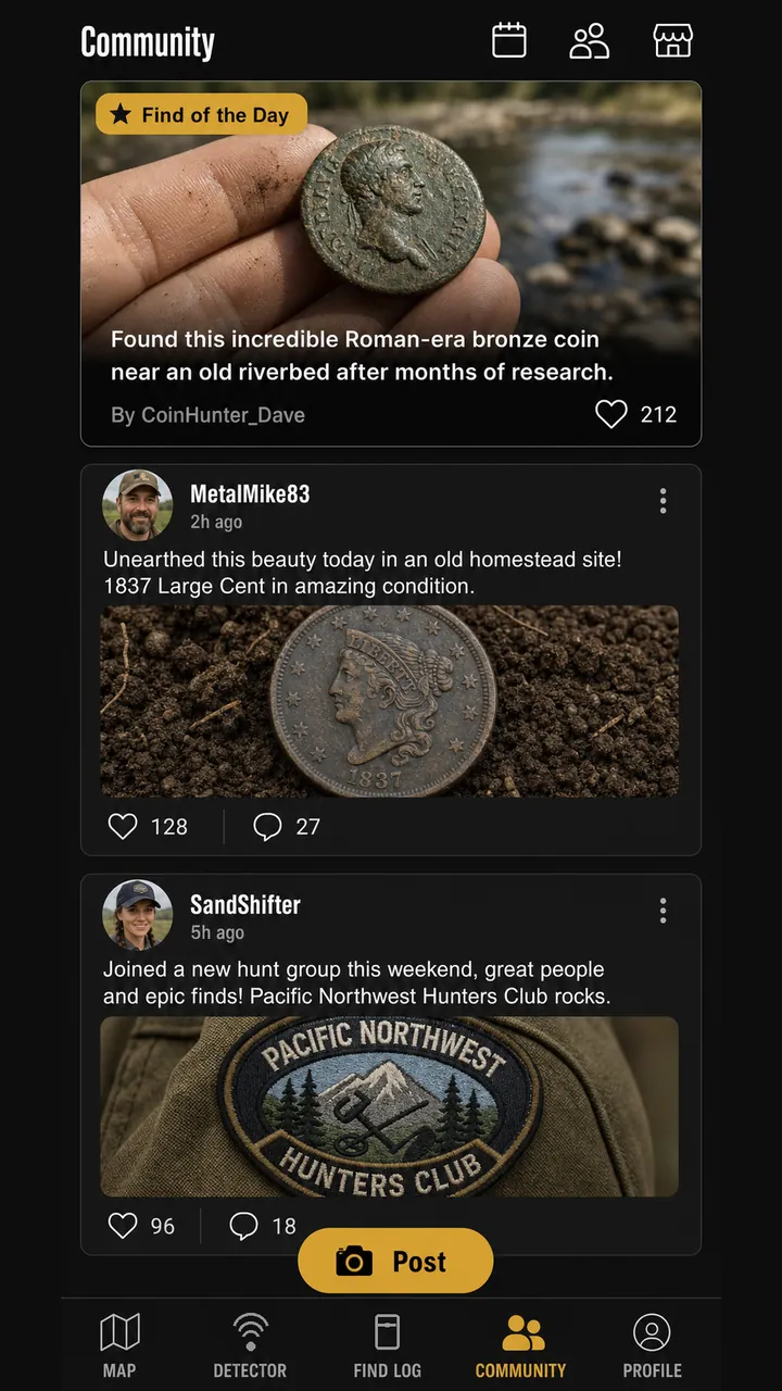
Post your best finds to the community feed, follow Find of the Day, search the club directory for people detecting near you, and build up XP, weekly challenges, and achievements as you go. Report and block controls are there when you need them.
- Community feed with Find of the Day
- Club directory searchable by region
- Report and block controls on posts and users
Honest limits: Anything you post is visible to other users. Never publish the precise location of a sensitive, protected, or productive historic site — share the find, not the coordinates. During a closed beta the feed and club directory will look sparse, because early testers are the first people in them.
Before you dig
Permission, law, and safety come first
DeepFind Hunter helps you hunt smarter. It is not permission, it is not a permit, and it is not a legal opinion.
Permission is yours to get
Get the landowner's consent before you set foot on private ground, and check the rules for any public land. Many parks, beaches, and reserves restrict or forbid detecting. Nothing in the app grants you access, and the app cannot tell you who owns a parcel.
Protected sites are off limits
Archaeological and historic sites, war graves, and human remains are protected by law in most places. If you suspect you have found something significant or human, stop, leave it in place, and contact the appropriate authority or heritage body.
Hunt safely
Water, tides, night hunting, and uneven ground carry real risk. Magnet fishing can raise unexploded ordnance, weapons, and contaminated metal — if you pull something dangerous, do not move it: leave the area and call local authorities. Prospecting sites can hide mine workings and mercury contamination.
Read our Terms of Service and Privacy Policy, and see Data Sources for where our map data comes from. Questions? support@deepfindhunter.com.
Ready to try the workflow?
DeepFind Hunter is in closed beta. Tell us about your detecting and the device you test on, and we will add you to the invite list.